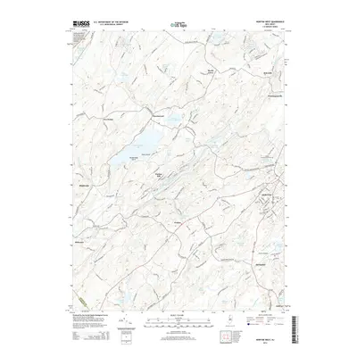
2014 Map of Newton West
USGS Topo · Published 2014About this map
The town of Newton serves as the focal point of this Sussex County landscape, where the urban grid meets the glacial lakes and valley systems of northern New Jersey. The southeastern corner is dominated by the county seat's infrastructure, including the Sussex County Community Coll campus, Newton Airport, and the Newton Cem. This modern survey reveals a region defined by its water resources, from the expansive Swartswood Lake and Paulins Kill Lake to the protected forests of the Delaware Water Gap National Recreation Area in the northwest.
Find a feature on this map
171 named features on this map. Tap any name to fly to it.
Don’t see what you’re looking for? This feature index may not catch every label — zoom into the map to look around manually.
Map Details
Editions of this 2014 Newton West Map
This is the sole edition of this map. No revisions or reprints were ever made.
Other maps of this area

1888 · Franklin
USGS Topo · 1:62,500

1888 · Hackettstown
USGS Topo · 1:62,500

1888 · Lake Hopatcong
USGS Topo · 1:62,500

1891 · Wallpack
USGS Topo · 1:62,500

1893 · Wallpack
USGS Topo · 1:62,500

1894 · Hackettstown
USGS Topo · 1:62,500

1894 · Lake Hopatcong
USGS Topo · 1:62,500

1894 · Franklin
USGS Topo · 1:62,500

1897 · Franklin
USGS Topo · 1:62,500

1898 · Lake Hopatcong
USGS Topo · 1:62,500