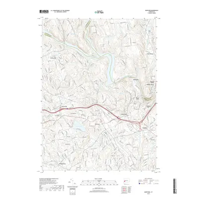
2018 Map of Newtown
USGS Topo · Published 2018About this map
Lake Lillinonah dominates the central landscape of this western Connecticut region, where the Housatonic River meets the Pootatuck River. The map captures a sophisticated network of residential and commercial settlements including Newtown, Sandy Hook, and South Britain, reflecting centuries of development along the river valleys and upland ridges. Genealogists can locate numerous local burying grounds such as Newtown Village Cem and Saint Roses Cem, while the unique cultural pocket of Russian Village sits near the river's edge. The terrain is defined by named rises like Taunton Hill and Sunset Hill, with several small water bodies including Taunton Pond and Curtis Pond punctuating the hills. This 2018 survey provides a clear view of the modern infrastructure and the geographic boundaries where Fairfield, Litchfield, and New Haven counties meet.
Find a feature on this map
62 named features on this map. Tap any name to fly to it.
Don’t see what you’re looking for? This feature index may not catch every label — zoom into the map to look around manually.
Map Details
Editions of this 2018 Newtown Map
This is the sole edition of this map. No revisions or reprints were ever made.
Other maps of this area

1889 · Derby
USGS Topo · 1:62,500

1891 · Derby
USGS Topo · 1:62,500

1892 · Danbury
USGS Topo · 1:62,500

1892 · New Milford
USGS Topo · 1:62,500

1893 · Waterbury
USGS Topo · 1:62,500

1893 · New Milford
USGS Topo · 1:62,500

1893 · Derby
USGS Topo · 1:62,500

1904 · New Milford
USGS Topo · 1:62,500

1904 · Waterbury
USGS Topo · 1:62,500

1904 · Litchfield
USGS Topo · 1:125,000