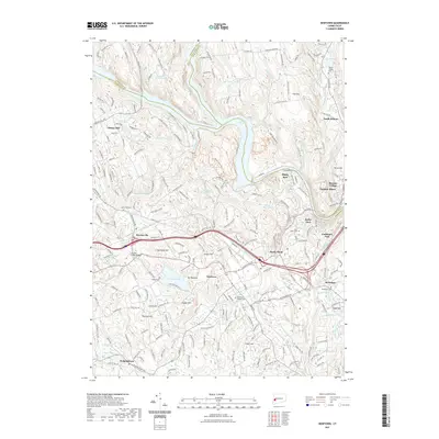
2021 Map of Newtown
USGS Topo · Published 2021About this map
Newtown and the surrounding villages of Sandy Hook and Hawleyville are situated at a significant crossroads of Fairfield County's transportation corridors. The 2021 landscape is defined by the convergence of major routes including I-84, Us HWY 6, and the Housatonic RR, reflecting the region's enduring role as a hub for transit and commerce. To the north, the Housatonic River and the expansive Lake Lillinonah carve through the terrain, separated from the residential centers by a series of prominent elevations like Mt Pleasant and Barnabas Hill.
Find a feature on this map
71 named features on this map. Tap any name to fly to it.
Don’t see what you’re looking for? This feature index may not catch every label — zoom into the map to look around manually.
Map Details
Editions of this 2021 Newtown Map
This is the sole edition of this map. No revisions or reprints were ever made.
Other maps of this area

1889 · Derby
USGS Topo · 1:62,500

1891 · Derby
USGS Topo · 1:62,500

1892 · Danbury
USGS Topo · 1:62,500

1892 · New Milford
USGS Topo · 1:62,500

1893 · Waterbury
USGS Topo · 1:62,500

1893 · New Milford
USGS Topo · 1:62,500

1893 · Derby
USGS Topo · 1:62,500

1904 · New Milford
USGS Topo · 1:62,500

1904 · Waterbury
USGS Topo · 1:62,500

1904 · Litchfield
USGS Topo · 1:125,000