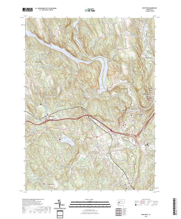
2024 Map of Newtown
USGS Topo · Published 2024About this map
The Housatonic River and Lake Lillinonah anchor this Fairfield County landscape, where the confluence of the Shepaug River and Pomperaug River defines the northern terrain. The village of Newtown serves as a central hub, surrounded by smaller historic settlements like Sandy Hook, Hawleyville, and South Britain. Genealogists will find a high density of burial sites across the quadrangle, ranging from the South Britain Burying Ground near the northern edge to the Resurrection Cem in the south. The area's transport evolution is evident in the path of the Housatonic Railroad and the heavy corridors of Interstate 84 and US Route 6. Notable landmarks like Mt Pleasant and Taunton Pond provide a sense of the varied topography that has shaped development from Dodgingtown to the Russian Village.
Find a feature on this map
63 named features on this map. Tap any name to fly to it.
Don’t see what you’re looking for? This feature index may not catch every label — zoom into the map to look around manually.
Map Details
Editions of this 2024 Newtown Map
This is the sole edition of this map. No revisions or reprints were ever made.
Other maps of this area

1889 · Derby
USGS Topo · 1:62,500

1891 · Derby
USGS Topo · 1:62,500

1892 · Danbury
USGS Topo · 1:62,500

1892 · New Milford
USGS Topo · 1:62,500

1893 · Waterbury
USGS Topo · 1:62,500

1893 · New Milford
USGS Topo · 1:62,500

1893 · Derby
USGS Topo · 1:62,500

1904 · New Milford
USGS Topo · 1:62,500

1904 · Waterbury
USGS Topo · 1:62,500

1904 · Litchfield
USGS Topo · 1:125,000