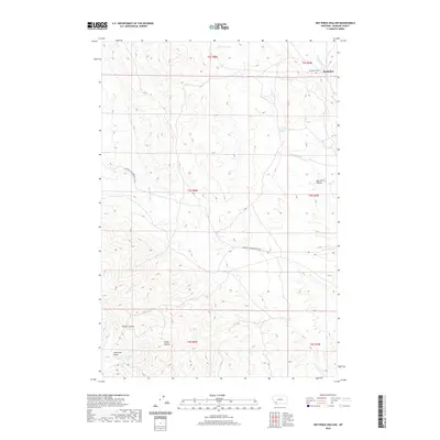
2020 Map of Nez Perce Hollow
USGS Topo · Published 2020About this map
Rochester sits in the northeast corner of this Madison County landscape, where the foothills meet the drainages of Rochester Cr. This high-elevation terrain is defined by its deep drainages and isolated springs, including Muller Spring and Reservoir Spring which feed into the rugged Reservoir Gulch. The road network is sparse, centered on the Melrose-Twin Bridges Co Rd crossing the central peaks. For genealogists and local historians, the Rochester Cem provides a critical anchor for tracing early residents of this mining-era settlement. The map reveals a complex system of named hollows and canyons such as Nez Perce Hollow and Timber Canyon, illustrating how the early inhabitants named the landscape based on resource availability and geographic landmarks like Sandy Hollow.
Find a feature on this map
19 named features on this map. Tap any name to fly to it.
Don’t see what you’re looking for? This feature index may not catch every label — zoom into the map to look around manually.
Map Details
Editions of this 2020 Nez Perce Hollow Map
This is the sole edition of this map. No revisions or reprints were ever made.
Other maps of this area

1893 · Dillon
USGS Topo · 1:250,000

1955 · Dillon
USGS Topo · 1:250,000

1957 · Dillon
USGS Topo · 1:250,000

1958 · Dillon
USGS Topo · 1:250,000

1960 · Glen
USGS Topo · 1:24,000

1960 · Block Mountain
USGS Topo · 1:24,000

1960 · Twin Bridges
USGS Topo · 1:62,500

1961 · Melrose
USGS Topo · 1:24,000

1961 · Earls Gulch
USGS Topo · 1:24,000

1961 · Wickiup Creek
USGS Topo · 1:24,000