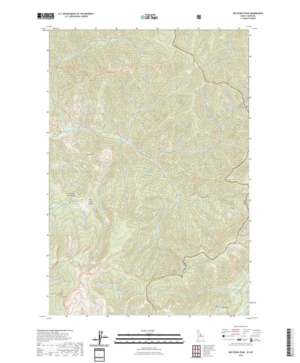
2024 Map of Nez Perce Peak
USGS Topo · Published 2024About this map
Nez Perce Peak and Nez Perce Pass anchor this high-elevation wilderness landscape where the Idaho Montana state line follows the Bitterroot crest. This 2024 edition documents the intersection of several vast protected areas, including the Selway-Bitterroot Wilderness and the Frank Church-River of No Return Wilderness. The map reveals a complex network of traditional routes, most notably the Nez Perce Indian Trl, which traverses the northern heights alongside Divide North Trl. Water drains through deep canyons via Deep Creek, which is joined by tributaries like Cayuse Creek and MacGruder Creek. The terrain is characterized by sharp ridgelines and named gaps like Hells Half Acre Saddle and Vance Creek Saddle, while Blue Joint Meadows provides a distinct break in the steep topography of the Bitterroot National Forest.
Find a feature on this map
48 named features on this map. Tap any name to fly to it.
Don’t see what you’re looking for? This feature index may not catch every label — zoom into the map to look around manually.
Map Details
Editions of this 2024 Nez Perce Peak Map
This is the sole edition of this map. No revisions or reprints were ever made.
Other maps of this area

1956 · Elk City
USGS Topo · 1:250,000

1960 · Elk City
USGS Topo · 1:250,000

1960 · Painted Rocks Lake
USGS Topo · 1:62,500

1962 · Wood Hump
USGS Topo · 1:24,000

1962 · Beaver Jack Mtn
USGS Topo · 1:24,000

1962 · Blue Joint
USGS Topo · 1:24,000

1962 · Nez Perce Peak
USGS Topo · 1:24,000
1964 · Mount Jerusalem
USGS Topo · 1:24,000

1966 · Watchtower Peak
USGS Topo · 1:24,000
1966 · Burnt Strip Mtn
USGS Topo · 1:24,000