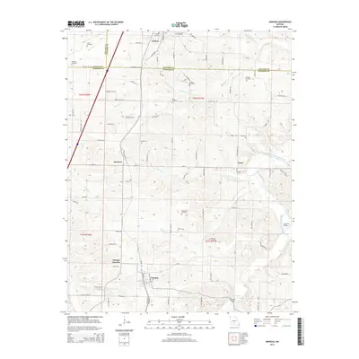
2015 Map of Niangua
USGS Topo · Published 2015About this map
The settlement of Conway and the surrounding borderlands of Laclede, Webster, and Dallas counties are defined by a complex network of creeks and early transport lines. The Frisco railroad corridor parallels major roads through the western half of the map, linking the communities of Sampson, Niangua Junction, and Niangua. This area is particularly rich in family-named burial sites, including the Letterman Cemetery, Williams Cemetery, and Hendrix Cemetery, which serve as vital markers for local genealogical research. The landscape transitions from the higher elevations of the western plains toward the winding waterways of the Osage Fork Gasconade River and the E Fork Niangua River. These river systems are crossed by notable landmarks such as the Hamilton Bridge and Copening Bridge, indicating the historical significance of these crossings for local commerce and rural connectivity between the small villages of Vance and its neighbors.
Find a feature on this map
97 named features on this map. Tap any name to fly to it.
Don’t see what you’re looking for? This feature index may not catch every label — zoom into the map to look around manually.
Map Details
Editions of this 2015 Niangua Map
This is the sole edition of this map. No revisions or reprints were ever made.
Other maps of this area

1939 · Long Lane
USGS Topo · 1:62,500

1941 · Lebanon
USGS Topo · 1:62,500

1942 · Long Lane
USGS Topo · 1:62,500

1943 · Lebanon
USGS Topo · 1:62,500

1946 · Niangua
USGS Topo · 1:62,500

1948 · Niangua
USGS Topo · 1:62,500

1954 · Springfield
USGS Topo · 1:250,000

1956 · Duncan
USGS Topo · 1:24,000

1956 · Rader
USGS Topo · 1:24,000

1958 · Springfield
USGS Topo · 1:250,000