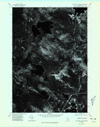
1975 Map of Nicatous Lake SE
USGS Topo · Published 1980About this map
Sabao Mountain dominates the central-eastern terrain of this 1975 orthophotoquad, serving as a prominent landmark in the wild interior of Maine. Unlike traditional topographic maps, this imagery reveals the actual density and texture of the forest cover and the intricate, dark patterns of the numerous unnamed lakes and ponds that define the glacial landscape of the Nicatous Lake region. The visual data provides a clear record of the timber management and logging access roads that carved through the woods during the mid-1970s, offering a distinctive perspective on the relationship between industry and the natural environment in Hancock County. Researchers can identify clearings and drainage patterns that are often generalized on standard contour maps.
Find a feature on this map
1 named feature on this map. Tap any name to fly to it.
Don’t see what you’re looking for? This feature index may not catch every label — zoom into the map to look around manually.
Map Details
Editions of this 1975 Nicatous Lake SE Map
This is the sole edition of this map. No revisions or reprints were ever made.
Other maps of this area

1929 · Lead Mountain
USGS Topo · 1:48,000

1932 · Nicatous Lake
USGS Topo · 1:48,000

1932 · Lead Mountain
USGS Topo · 1:62,500

1934 · Nicatous Lake
USGS Topo · 1:62,500

1941 · Tug Mountain
USGS Topo · 1:62,500

1941 · Wabassus Lake
USGS Topo · 1:62,500

1943 · Tug Mountain
USGS Topo · 1:62,500

1943 · Wabassus Lake
USGS Topo · 1:62,500

1948 · Bangor
USGS Topo · 1:250,000

1953 · Wabassus Lake
USGS Topo · 1:62,500