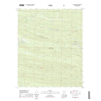
2020 Map of Nichols Mountain
USGS Topo · Published 2020About this map
The settlement of Shady and the designated waters of the Cossatot Wild and Scenic River define this corner of the Ouachita National Forest. This section of Polk County is characterized by a dense network of forest roads and trails, including the Wolf Pen Gap system and the Crystal Scenic route, which navigate through complex terrain such as the Hanna Range and Missouri Mountains. The hydrology is equally intricate, with the Saline River and Little Missouri Wild and Scenic River winding through narrow valleys between peaks like Nichols Mtn and Tall Peak. High-elevation landmarks such as Sugartree Gap and Three Oak Gap serve as critical navigation points within the timbered slopes. The presence of Bard Springs in the southeastern quadrant suggests a focal point for activity amidst the ridges of Blaylock Mtn and Buckeye Mtn.
Find a feature on this map
75 named features on this map. Tap any name to fly to it.
Don’t see what you’re looking for? This feature index may not catch every label — zoom into the map to look around manually.
Map Details
Editions of this 2020 Nichols Mountain Map
This is the sole edition of this map. No revisions or reprints were ever made.
Other maps of this area

1890 · Mount Ida
USGS Topo · 1:125,000

1890 · Poteau Mountain
USGS Topo · 1:125,000

1899 · Poteau Mountain
USGS Topo · 1:125,000

1906 · Caddo Gap
USGS Topo · 1:125,000

1913 · De Queen
USGS Topo · 1:125,000

1936 · Athens
USGS Topo · 1:48,000

1942 · Athens
USGS Topo · 1:62,500

1950 · Mcalester
USGS Topo · 1:250,000

1955 · Little Rock
USGS Topo · 1:250,000

1956 · Little Rock
USGS Topo · 1:250,000