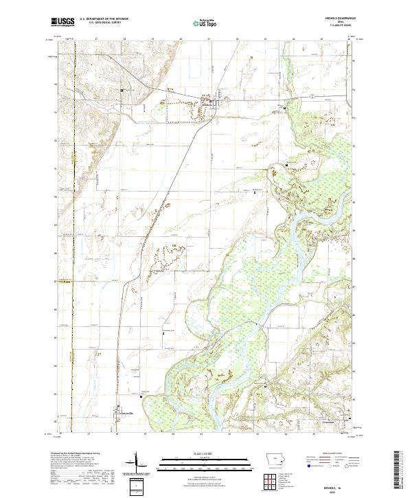
2022 Map of Nichols
USGS Topo · Published 2022About this map
The Cedar River floodplain dominates this portion of Muscatine County, where complex wetlands and backwaters define the eastern landscape. The town of Nichols sits at the junction of several drainage systems, including Hockeys Slough and Wapsinonoc Creek. This survey reveals a high density of small rural burial grounds, such as Watkins Cem, Wesson Cem, and Lone Tree Cem, which provide specific geographic anchors for local genealogical research. To the south, the settlement of Conesville is linked by the Hoover Nature Trl, following a former transport corridor through the river valley. The map details the rural road network at the intersection of Johnson, Muscatine, and Louisa counties, illustrating how modern parcels still align with the township and range lines of the original land surveys.
Find a feature on this map
67 named features on this map. Tap any name to fly to it.
Don’t see what you’re looking for? This feature index may not catch every label — zoom into the map to look around manually.
Map Details
Editions of this 2022 Nichols Map
This is the sole edition of this map. No revisions or reprints were ever made.
Other maps of this area

1891 · Wilton Junction
USGS Topo · 1:62,500

1894 · West Liberty
USGS Topo · 1:62,500

1901 · Stanwood
USGS Topo · 1:125,000

1948 · Muscatine
USGS Topo · 1:62,500

1958 · Davenport
USGS Topo · 1:250,000

1961 · Davenport
USGS Topo · 1:250,000

1962 · Davenport
USGS Topo · 1:250,000
1965 · West Liberty
USGS Topo · 1:24,000

1965 · Letts
USGS Topo · 1:24,000
1965 · Muscatine NW
USGS Topo · 1:24,000