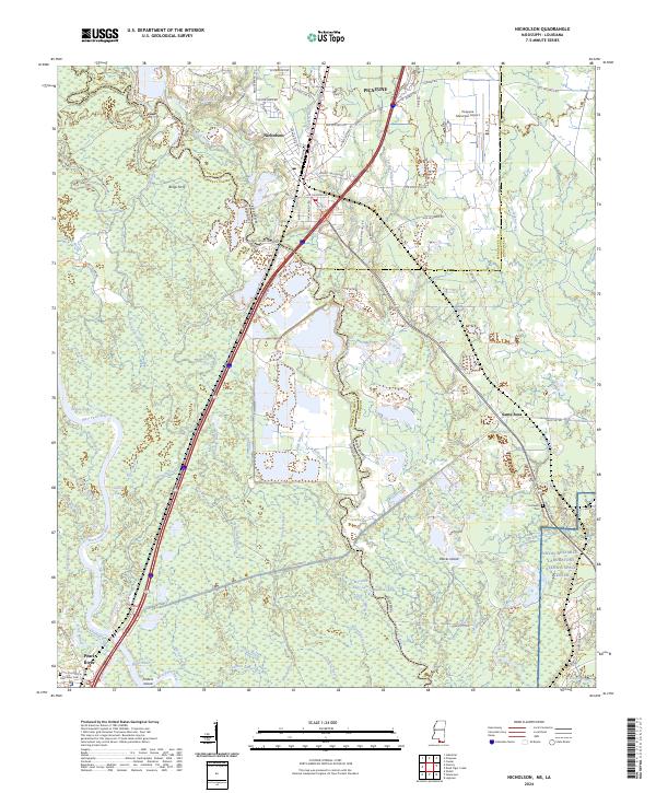
2024 Map of Nicholson
USGS Topo · Published 2024About this map
The Pearl River and its intricate network of bayous and swamps form the core of this landscape along the Mississippi and Louisiana border. In this region, the Bogue Chitto National Wildlife Refuge preserves the vast Honey Island Swamp, where water bodies like Crooked Bayou and Clear Bayou carve through the bottomlands. The settlement pattern reflects the area's transition from rural river outposts to modern technical hubs, most notably seen in the presence of the Naval Research Laboratory Stennis Space Center in the southeast.
Find a feature on this map
99 named features on this map. Tap any name to fly to it.
Don’t see what you’re looking for? This feature index may not catch every label — zoom into the map to look around manually.
Map Details
Editions of this 2024 Nicholson Map
This is the sole edition of this map. No revisions or reprints were ever made.
Other maps of this area

1914 · Nicholson
USGS Topo · 1:62,500

1921 · Nicholson
USGS Topo · 1:62,500

1935 · Slidell
USGS Topo · 1:62,500

1939 · Slidell
USGS Topo · 1:62,500

1941 · Honey Island
USGS Topo · 1:31,680

1942 · Walkiah Bluff
USGS Topo · 1:31,680

1950 · Haaswood
USGS Topo · 1:31,680

1950 · Slidell
USGS Topo · 1:62,500

1953 · Mobile
USGS Topo · 1:250,000

1954 · Haaswood
USGS Topo · 1:31,680