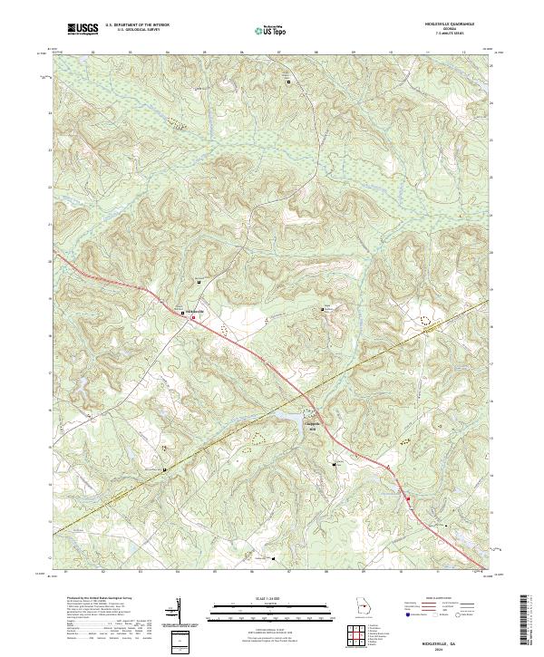
2024 Map of Nicklesville
USGS Topo · Published 2024About this map
Chappells Mill and the crossroads at Nicklesville anchor this survey of the boundary lands between Wilkinson and Laurens counties. The landscape is defined by the winding course of Big Sandy Creek and its many tributaries, including South Sandy Creek and Cedar Creek. This era of the region’s development is marked by a dense network of country roads connecting isolated family burial grounds and small community centers. Genealogy researchers will find numerous named cemeteries such as Jordan Stream Cem, Mount Tilla Cem, and Hagin - Fordham Cem, often situated near older residential nodes and creek crossings. The map illustrates a rural interior where water-driven industry at Chappells Mill historically served as a local hub, and newer landmarks like Townsend Lake indicate shifts in land use toward recreation and residential development near Timber Lakes Dr.
Find a feature on this map
55 named features on this map. Tap any name to fly to it.
Don’t see what you’re looking for? This feature index may not catch every label — zoom into the map to look around manually.
Map Details
Editions of this 2024 Nicklesville Map
This is the sole edition of this map. No revisions or reprints were ever made.
Other maps of this area

1916 · Irwinton
USGS Topo · 1:62,500

1920 · Irwinton
USGS Topo · 1:62,500

1957 · Macon
USGS Topo · 1:250,000

1958 · Macon
USGS Topo · 1:250,000

1962 · Oconee
USGS Topo · 1:24,000

1964 · Macon
USGS Topo · 1:250,000
1973 · Irwinton
USGS Topo · 1:24,000
1973 · Toomsboro
USGS Topo · 1:24,000

1974 · Cow Hell Swamp
USGS Topo · 1:24,000

1974 · Danville East
USGS Topo · 1:24,000