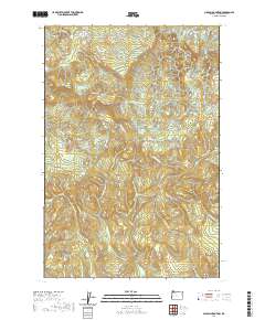
2020 Map of Nicolai Mountain
USGS Topo · Published 2020About this map
Nicolai Mtn dominates this portion of Clatsop County, where the high ridges of the Northern Oregon Coast Range separate the drainage basins of the Columbia River and the Nehalem Valley. The landscape is defined by an extensive network of forestry and logging roads, including the Big Creek Mainline, Foster Mainline, and the Nicolai-Beneke Grade, illustrating the region's long-standing reliance on timber extraction. Notable water features like Gnat Creek Falls and the secluded Lost Lake are tucked into the steep drainages of Nicolai Ridge and Porter Ridge. The intricate topographic detail reveals how several significant streams, such as Fishhawk Cr, Northrup Cr, and Gnat Cr, originate from these heights before descending into the surrounding lowlands.
Find a feature on this map
40 named features on this map. Tap any name to fly to it.
Don’t see what you’re looking for? This feature index may not catch every label — zoom into the map to look around manually.
Map Details
Editions of this 2020 Nicolai Mountain Map
This is the sole edition of this map. No revisions or reprints were ever made.
Other maps of this area

1939 · Saddle Mountain
USGS Topo · 1:62,500

1940 · Svensen
USGS Topo · 1:62,500

1941 · Keasey
USGS Topo · 1:62,500

1941 · Cathlamet
USGS Topo · 1:62,500

1943 · Keasey
USGS Topo · 1:62,500

1943 · Saddle Mtn.
USGS Topo · 1:62,500

1948 · Vancouver
USGS Topo · 1:250,000

1950 · Vancouver
USGS Topo · 1:250,000

1950 · Vancouver
USGS Topo · 1:250,000

1953 · Hoquiam
USGS Topo · 1:250,000