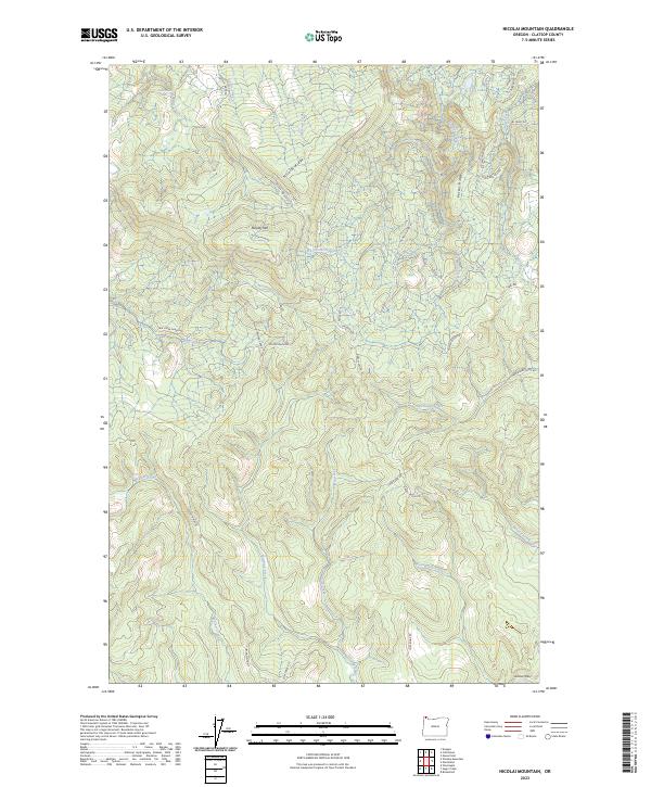
2023 Map of Nicolai Mountain
USGS Topo · Published 2023About this map
Nicolai Mtn and the surrounding Nicolai Ridge define this upland portion of the Northern Oregon Coast Range. This high ground serves as the headwaters for a dense network of drainages, including Gnat Creek flowing north and Fishhawk Creek moving toward the southeast. The landscape is characterized by a complex system of logging and resource roads, such as the Big Creek Mainline, Foster Mainline, and the Nicolai-Beneke Grade, which trace the contours of the ridges and creek valleys. In the far southeastern corner, the terrain descends toward the Nehalem Valley. Notable water bodies like Lost Lake and various forks of Plympton Creek are interspersed throughout the heavily timbered drainages, illustrating the drainage patterns that have historically supported the region's timber industry.
Find a feature on this map
40 named features on this map. Tap any name to fly to it.
Don’t see what you’re looking for? This feature index may not catch every label — zoom into the map to look around manually.
Map Details
Editions of this 2023 Nicolai Mountain Map
This is the sole edition of this map. No revisions or reprints were ever made.
Other maps of this area

1939 · Saddle Mountain
USGS Topo · 1:62,500

1940 · Svensen
USGS Topo · 1:62,500

1941 · Keasey
USGS Topo · 1:62,500

1941 · Cathlamet
USGS Topo · 1:62,500

1943 · Keasey
USGS Topo · 1:62,500

1943 · Saddle Mtn.
USGS Topo · 1:62,500

1948 · Vancouver
USGS Topo · 1:250,000

1950 · Vancouver
USGS Topo · 1:250,000

1950 · Vancouver
USGS Topo · 1:250,000

1953 · Hoquiam
USGS Topo · 1:250,000