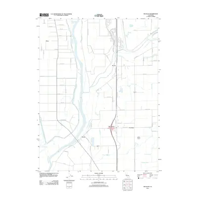
2012 Map of Nicolaus
USGS Topo · Published 2012About this map
The Feather River corridor in Sutter County defines this agricultural landscape, where the confluence of the Bear River and the main channel creates a complex network of waterways including Yankee Slough and Ping Slough. Central to the region is Nicolaus, a historic river settlement complemented by East Nicolaus and Rio Oso further east. The map highlights the intersection of rural life and transportation, from the levee-protected banks of the Feather River to the inland James Brothers Airport and the community of Trowbridge. This survey documents a territory shaped by its drainage patterns, evident in the numerous sloughs like Bunkham Slough and Nelson Slough that lace the fields. Local history is anchored at sites such as Fairview Cem and Nicolaus Cem, which serve as permanent markers of the families who settled this fertile valley.
Find a feature on this map
72 named features on this map. Tap any name to fly to it.
Don’t see what you’re looking for? This feature index may not catch every label — zoom into the map to look around manually.
Map Details
Editions of this 2012 Nicolaus Map
This is the sole edition of this map. No revisions or reprints were ever made.
Other maps of this area

1888 · Marysville
USGS Topo · 1:125,000

1888 · Smartsville
USGS Topo · 1:125,000

1891 · Sacramento
USGS Topo · 1:125,000

1891 · Marysville
USGS Topo · 1:125,000

1891 · Smartsville
USGS Topo · 1:125,000

1892 · Sacramento
USGS Topo · 1:125,000

1892 · Smartsville
USGS Topo · 1:125,000

1893 · Sacramento
USGS Topo · 1:125,000

1894 · Smartsville
USGS Topo · 1:125,000

1894 · Marysville
USGS Topo · 1:125,000