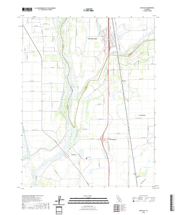
2022 Map of Nicolaus
USGS Topo · Published 2022About this map
The Feather River defines the western corridor of this landscape, its winding course flanked by the Sutter Co Yuba Co line and a complex network of wetlands. In the Sacramento Valley, the settlements of Nicolaus and East Nicolaus stand as key local hubs, while Rio Oso and Trowbridge anchor the eastern agricultural plains. The terrain is a mosaic of water management and irrigation, featuring an extensive system of sloughs including Ping Slough, Yankee Slough, and Bunkham Slough.
Find a feature on this map
83 named features on this map. Tap any name to fly to it.
Don’t see what you’re looking for? This feature index may not catch every label — zoom into the map to look around manually.
Map Details
Editions of this 2022 Nicolaus Map
This is the sole edition of this map. No revisions or reprints were ever made.
Other maps of this area

1888 · Marysville
USGS Topo · 1:125,000

1888 · Smartsville
USGS Topo · 1:125,000

1891 · Sacramento
USGS Topo · 1:125,000

1891 · Marysville
USGS Topo · 1:125,000

1891 · Smartsville
USGS Topo · 1:125,000

1892 · Sacramento
USGS Topo · 1:125,000

1892 · Smartsville
USGS Topo · 1:125,000

1893 · Sacramento
USGS Topo · 1:125,000

1894 · Smartsville
USGS Topo · 1:125,000

1894 · Marysville
USGS Topo · 1:125,000