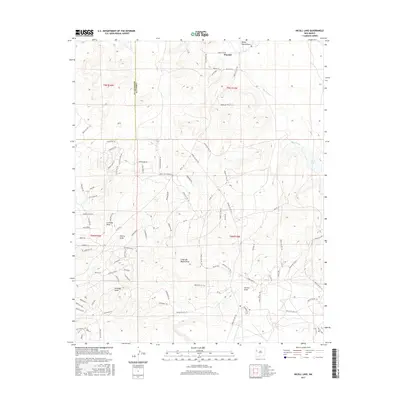
2017 Map of Nicoll Lake
USGS Topo · Published 2017About this map
Pinehill sits near the northern boundary of this high-altitude landscape where the borders of McKinley Co and Cibola Co meet. The geography is defined by a series of significant drainage systems, including the Rio Pescado and several named draws that navigate the undulating terrain, such as Loma del Medio Draw and Atarque Draw. The eastern portion of the sheet is marked by the presence of Nicoll Lake, a rare water feature in this arid environment. The road network reflects a specialized infrastructure of Indian Service Routes and Bureau of Indian Affairs roads, such as Indian Svc Rte 172 and BIA Rd 114. Settlement patterns are modern but sparse, with residential developments appearing along descriptive local ways like Easy Living Rd and Soaring Hawk Ln, indicating the contemporary character of this high-country region.
Find a feature on this map
92 named features on this map. Tap any name to fly to it.
Don’t see what you’re looking for? This feature index may not catch every label — zoom into the map to look around manually.
Map Details
Editions of this 2017 Nicoll Lake Map
This is the sole edition of this map. No revisions or reprints were ever made.
Other maps of this area

1886 · Wingate
USGS Topo · 1:250,000

1892 · Wingate
USGS Topo · 1:250,000

1954 · Saint Johns
USGS Topo · 1:250,000

1954 · Gallup
USGS Topo · 1:250,000

1957 · Saint Johns
USGS Topo · 1:250,000

1958 · Gallup
USGS Topo · 1:250,000

1958 · Saint Johns
USGS Topo · 1:250,000

1959 · Gallup
USGS Topo · 1:250,000

1962 · Gallup
USGS Topo · 1:250,000

1962 · Saint Johns
USGS Topo · 1:250,000
Featured Places
- Eastern Navajo Agency, NM
- Mountain View, Eastern Navajo Agency
- Pinehill, Eastern Navajo Agency
- McKinley County, NM
- Cibola County, NM