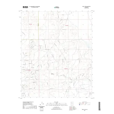
2020 Map of Nicoll Lake
USGS Topo · Published 2020About this map
Rio Pescado winds through this high-desert landscape on the border of McKinley and Cibola counties. The topography is defined by a series of significant drainage systems, including Loma del Medio Draw and Coyote Canyon, which carve through the arid terrain. While the area is largely characterized by open space and natural landforms, a modern network of local roads has emerged, bearing evocative names like Great White Father Rd, Soaring Hawk Ln, and Skinwalker. To the east, Nicoll Lake sits as a primary water feature in an otherwise dry environment. This contemporary survey by the U.S. Geological Survey illustrates the intersection of traditional land use and newer residential development patterns in this portion of New Mexico.
Find a feature on this map
84 named features on this map. Tap any name to fly to it.
Don’t see what you’re looking for? This feature index may not catch every label — zoom into the map to look around manually.
Map Details
Editions of this 2020 Nicoll Lake Map
This is the sole edition of this map. No revisions or reprints were ever made.
Other maps of this area

1886 · Wingate
USGS Topo · 1:250,000

1892 · Wingate
USGS Topo · 1:250,000

1954 · Saint Johns
USGS Topo · 1:250,000

1954 · Gallup
USGS Topo · 1:250,000

1957 · Saint Johns
USGS Topo · 1:250,000

1958 · Gallup
USGS Topo · 1:250,000

1958 · Saint Johns
USGS Topo · 1:250,000

1959 · Gallup
USGS Topo · 1:250,000

1962 · Gallup
USGS Topo · 1:250,000

1962 · Saint Johns
USGS Topo · 1:250,000
Featured Places
- Eastern Navajo Agency, NM
- Mountain View, Eastern Navajo Agency
- Pinehill, Eastern Navajo Agency
- McKinley County, NM
- Cibola County, NM