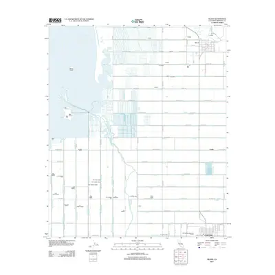
2012 Map of Niland
USGS Topo · Published 2012About this map
The Salton Sea dominates the northwestern portion of this landscape, its shoreline dotted with distinctive geological features like Mullet Island, Red Hill, and Rock Hill. This 2012 survey illustrates the highly engineered agricultural environment of Imperial County, defined by a dense grid of irrigation infrastructure including the U Lateral, Vail Drain, and the Pumice Drain. The settlement of Niland serves as a local hub near the Southern Pacific tracks, while the city of Calipatria anchors the southern boundary. Between these centers, the map reveals a meticulously partitioned terrain of farm roads and drainage canals. Aviation history is noted at the Cliff Hatfield Memorial Airport, while recreational access to the inland sea is indicated at the Red Hill Marina. The geometry of the canals, such as the Vail Lateral Four-A, demonstrates the complex water management required to sustain this desert basin.
Find a feature on this map
129 named features on this map. Tap any name to fly to it.
Don’t see what you’re looking for? This feature index may not catch every label — zoom into the map to look around manually.
Map Details
Editions of this 2012 Niland Map
This is the sole edition of this map. No revisions or reprints were ever made.
Other maps of this area

1940 · Iris
USGS Topo · 1:62,500

1940 · Frink
USGS Topo · 1:62,500

1940 · Iris Pass
USGS Topo · 1:62,500

1944 · Calipatria
USGS Topo · 1:62,500

1944 · Frink
USGS Topo · 1:62,500

1945 · Iris Pass
USGS Topo · 1:62,500

1945 · Iris
USGS Topo · 1:62,500

1954 · Salton Sea
USGS Topo · 1:250,000

1955 · Salton Sea
USGS Topo · 1:250,000
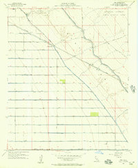
1956 · Iris
USGS Topo · 1:24,000