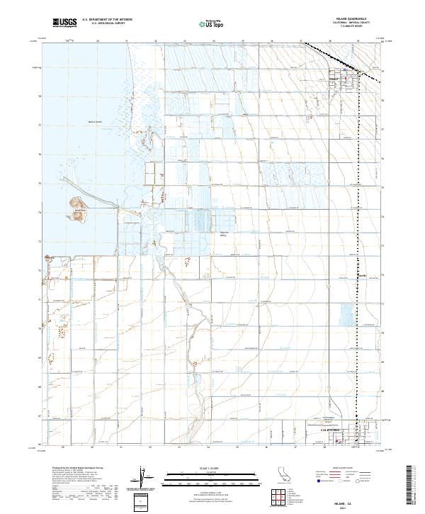
2021 Map of Niland
USGS Topo · Published 2021About this map
Niland and Calipatria anchor this 2021 study of the Imperial Valley, where a complex grid of water management infrastructure sustains the desert landscape. The map meticulously documents the extensive system of irrigation and drainage essential to the region, including the Alamo River and alphabetical series ranging from T Drain and S Lateral down to D Lateral W. To the west, the encroaching waters of the Salton Sea surround distinctive landforms such as Mullet Island, Red Island, and Rock Hill, illustrating the evolving shoreline of California's largest inland lake.
Find a feature on this map
99 named features on this map. Tap any name to fly to it.
Don’t see what you’re looking for? This feature index may not catch every label — zoom into the map to look around manually.
Map Details
Editions of this 2021 Niland Map
This is the sole edition of this map. No revisions or reprints were ever made.
Other maps of this area

1940 · Iris
USGS Topo · 1:62,500

1940 · Frink
USGS Topo · 1:62,500

1940 · Iris Pass
USGS Topo · 1:62,500

1944 · Calipatria
USGS Topo · 1:62,500

1944 · Frink
USGS Topo · 1:62,500

1945 · Iris Pass
USGS Topo · 1:62,500

1945 · Iris
USGS Topo · 1:62,500

1954 · Salton Sea
USGS Topo · 1:250,000

1955 · Salton Sea
USGS Topo · 1:250,000
1956 · Iris
USGS Topo · 1:24,000