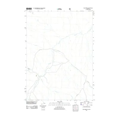
2011 Map of Nile Spring
USGS Topo · Published 2011About this map
Trout Creek Ranch sits at the heart of this high-desert landscape in Box Elder County, where seasonal drainages and vital water sources define the patterns of human and animal life. The drainage of Goose Creek dominates the terrain, winding north through the quadrangle and gathering waters from tributaries like Jay Creek and Hardesty Creek. These riparian corridors are punctuated by essential landmarks such as Nile Spring, Point Spring, and Mud Spring, which have historically served as critical anchors for ranching operations and travelers in this arid region.
Find a feature on this map
12 named features on this map. Tap any name to fly to it.
Don’t see what you’re looking for? This feature index may not catch every label — zoom into the map to look around manually.
Map Details
Editions of this 2011 Nile Spring Map
This is the sole edition of this map. No revisions or reprints were ever made.
Other maps of this area

1954 · Pocatello
USGS Topo · 1:250,000

1954 · Brigham City
USGS Topo · 1:250,000

1955 · Twin Falls
USGS Topo · 1:250,000

1955 · Wells
USGS Topo · 1:250,000

1958 · Wells
USGS Topo · 1:250,000

1958 · Twin Falls
USGS Topo · 1:250,000

1958 · Pocatello
USGS Topo · 1:250,000

1958 · Brigham City
USGS Topo · 1:250,000

1959 · Cotton Thomas Basin
USGS Topo · 1:62,500

1961 · Wells
USGS Topo · 1:250,000