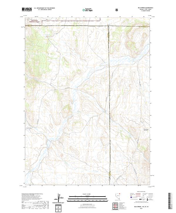
2021 Map of Nile Spring
USGS Topo · Published 2021About this map
The high-desert terrain where Nevada, Utah, and Idaho meet comes into sharp focus in this detailed survey, dominated by the Goose Creek Mountains and the southern edge of the Sawtooth National Forest. This intersection of state lines creates a complex jurisdictional landscape centered on the namesake Nile Spring and the drainage of Goose Cr. The region is defined by its water sources and ranching access, with several springs like Mud Spring providing vital points of reference across the arid landscape. Historically significant routes such as Goose Creek Rd and Hardesty Rd follow the natural contours of the drainages, including Hardesty Cr and Trout Cr, illustrating how the geography of the Great Basin dictated human movement and settlement patterns well into the modern era.
Find a feature on this map
26 named features on this map. Tap any name to fly to it.
Don’t see what you’re looking for? This feature index may not catch every label — zoom into the map to look around manually.
Map Details
Editions of this 2021 Nile Spring Map
This is the sole edition of this map. No revisions or reprints were ever made.
Other maps of this area

1954 · Pocatello
USGS Topo · 1:250,000

1954 · Brigham City
USGS Topo · 1:250,000

1955 · Twin Falls
USGS Topo · 1:250,000

1955 · Wells
USGS Topo · 1:250,000

1958 · Wells
USGS Topo · 1:250,000

1958 · Twin Falls
USGS Topo · 1:250,000

1958 · Pocatello
USGS Topo · 1:250,000

1958 · Brigham City
USGS Topo · 1:250,000

1959 · Cotton Thomas Basin
USGS Topo · 1:62,500

1961 · Wells
USGS Topo · 1:250,000