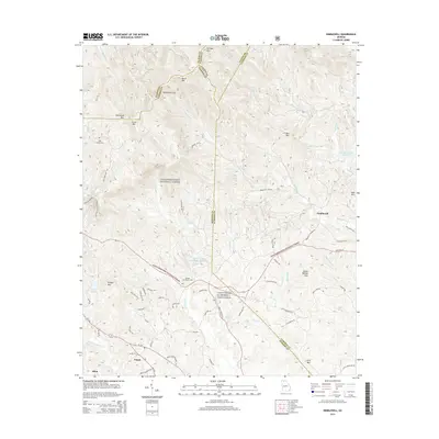
2014 Map of Nimblewill
USGS Topo · Published 2014About this map
Camp Frank D. Merrill, Dahlonega anchors the southern portion of this landscape, situated near the intersection of State Rte 52 and Bailey Waters Rd. The terrain is defined by the high ridges of the Chattahoochee National Forest, where summits like Springer Mtn and Amicalola Mtn overlook the headwaters of Nimblewill Cr and Cochrans Cr. The map captures the quiet intersection of mountain geography and small-town life in communities like Nimblewill and Emma. Local heritage is preserved in sites such as High Shoals Cem. and Spriggs Summerour Cem, while the industrial and natural hydrology of the area is represented by Rome Kraft Company Lake and the iconic Amicalola Falls. This 2014 survey documents the complex network of forest service roads and local trails, including Klinger Trl and Little Bear Trl, that crisscross the county lines of Gilmer, Fannin, Dawson, and Lumpkin.
Find a feature on this map
83 named features on this map. Tap any name to fly to it.
Don’t see what you’re looking for? This feature index may not catch every label — zoom into the map to look around manually.
Map Details
Editions of this 2014 Nimblewill Map
This is the sole edition of this map. No revisions or reprints were ever made.
Other maps of this area

1888 · Ellijay
USGS Topo · 1:125,000

1890 · Suwanee
USGS Topo · 1:125,000

1892 · Ellijay
USGS Topo · 1:125,000

1894 · Suwanee
USGS Topo · 1:125,000

1898 · Ellijay
USGS Topo · 1:125,000

1911 · Ellijay
USGS Topo · 1:125,000

1926 · Tate
USGS Topo · 1:62,500

1928 · Tate
USGS Topo · 1:62,500

1935 · Noontootla
USGS Topo · 1:24,000

1935 · Tickanetley
USGS Topo · 1:24,000