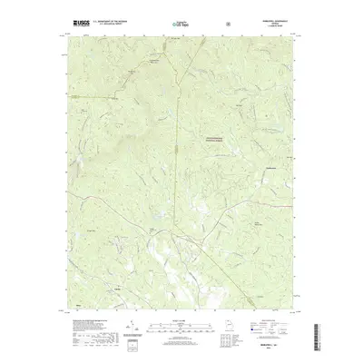
2020 Map of Nimblewill
USGS Topo · Published 2020About this map
Nimblewill serves as a central point in this mountainous section of the Chattahoochee National Forest, where the intersections of Nimblewill Church Rd and Nimblewill Gap Rd mark the transition from valley settlements to high ridges. The landscape is defined by the high peaks of Springer Mtn and Amicalola Mtn, connected by the Appalachian Approach Trail. A network of water bodies, including the Rome Kraft Company Lake and Amicalola Lake, provides a counterpoint to the steep terrain of Bull Mtn and Grogan Mtn. Local history is anchored by sites like High Shoals Cem and the Spriggs Summerour Cem, while the northern reaches features numerous routes such as the Bare Hare Trail and Lance Creek Trail. The presence of the Hike Inn Lodge and dramatic landmarks like Cochran Creek Falls highlights the area's long-standing role as a destination for navigation through the southern Blue Ridge mountains.
Find a feature on this map
94 named features on this map. Tap any name to fly to it.
Don’t see what you’re looking for? This feature index may not catch every label — zoom into the map to look around manually.
Map Details
Editions of this 2020 Nimblewill Map
This is the sole edition of this map. No revisions or reprints were ever made.
Other maps of this area

1888 · Ellijay
USGS Topo · 1:125,000

1890 · Suwanee
USGS Topo · 1:125,000

1892 · Ellijay
USGS Topo · 1:125,000

1894 · Suwanee
USGS Topo · 1:125,000

1898 · Ellijay
USGS Topo · 1:125,000

1911 · Ellijay
USGS Topo · 1:125,000

1926 · Tate
USGS Topo · 1:62,500

1928 · Tate
USGS Topo · 1:62,500

1935 · Noontootla
USGS Topo · 1:24,000

1935 · Tickanetley
USGS Topo · 1:24,000