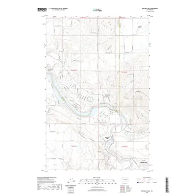
2020 Map of Nine Mile Falls
USGS Topo · Published 2020About this map
Nine Mile Falls serves as a focal point along the Spokane River in this modern topographical survey of the borderlands between Stevens Co and Spokane Co. The landscape transition is evident as the river flows through Riverside State Park, widening into Long Lake to the west. To the northeast, the terrain levels out into the broad agricultural expanse of Wild Rose Prairie, while the southern reaches of the map show the encroaching residential expansion of Spokane near Pine Bluff.
Find a feature on this map
106 named features on this map. Tap any name to fly to it.
Don’t see what you’re looking for? This feature index may not catch every label — zoom into the map to look around manually.
Map Details
Editions of this 2020 Nine Mile Falls Map
This is the sole edition of this map. No revisions or reprints were ever made.
Other maps of this area

1901 · Spokane
USGS Topo · 1:125,000

1943 · Medical Lake
USGS Topo · 1:62,500

1944 · Clayton
USGS Topo · 1:62,500

1949 · Deer Park
USGS Topo · 1:62,500

1950 · Spokane NW
USGS Topo · 1:24,000

1950 · Spokane
USGS Topo · 1:62,500

1950 · Clayton
USGS Topo · 1:62,500

1951 · Deer Park
USGS Topo · 1:62,500

1954 · Airway Heights
USGS Topo · 1:24,000

1954 · Medical Lake
USGS Topo · 1:62,500