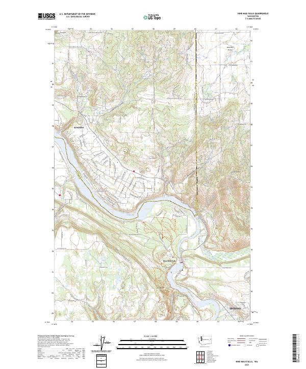
2023 Map of Nine Mile Falls
USGS Topo · Published 2023About this map
The Spokane River winds through this northern Washington landscape, shaping the development of communities like Suncrest and Nine Mile Falls. In this recent era, the river remains a central geological and recreational corridor, featuring the Spokane River Centennial State Park Trl and the expanse of Long Lake. The map details the transition from the upland plateau of Wild Rose Prairie in the northeast to the deeply incised drainages of Holmes Canyon and Little Sandy Canyon. Smaller settlements and landmarks such as Pine Bluff and Lookout Mtn are set against a network of local roads including Wallbridge Rd and Swenson Rd. The convergence of the Little Spokane River with the main river channel highlights the area's complex hydrology and rugged terrain transitions.
Find a feature on this map
112 named features on this map. Tap any name to fly to it.
Don’t see what you’re looking for? This feature index may not catch every label — zoom into the map to look around manually.
Map Details
Editions of this 2023 Nine Mile Falls Map
This is the sole edition of this map. No revisions or reprints were ever made.
Other maps of this area

1901 · Spokane
USGS Topo · 1:125,000

1943 · Medical Lake
USGS Topo · 1:62,500

1944 · Clayton
USGS Topo · 1:62,500

1949 · Deer Park
USGS Topo · 1:62,500

1950 · Spokane NW
USGS Topo · 1:24,000

1950 · Spokane
USGS Topo · 1:62,500

1950 · Clayton
USGS Topo · 1:62,500

1951 · Deer Park
USGS Topo · 1:62,500

1954 · Airway Heights
USGS Topo · 1:24,000

1954 · Medical Lake
USGS Topo · 1:62,500