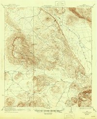
1937 Map of Nine Point Mesa
USGS Topo · Published 1937About this map
Nine Point Mesa dominates this 1917 Brewster County survey, standing as a prominent high-desert landmark above a network of isolated ranching outposts. The landscape reveals the early 20th-century cattle economy of the Big Bend region, where named water sources like Cottonwood Spring and Alamo Spring dictated the placement of homesteads. The map traces the winding course of Chalk Draw as it cuts between the Santiago Mountains and the lower mesas.
Find a feature on this map
40 named features on this map. Tap any name to fly to it.
Don’t see what you’re looking for? This feature index may not catch every label — zoom into the map to look around manually.
Map Details
Editions of this 1937 Nine Point Mesa Map
2 editions found

Other maps of this area

1903 · Chisos Mountains
USGS Topo · 1:125,000

1903 · Terlingua
USGS Topo · 1:125,000

1904 · Terlingua
USGS Topo · 1:125,000

1905 · Chisos Mountains
USGS Topo · 1:125,000

1917 · Agua Fria
USGS Topo · 1:62,500

1917 · Santiago Peak
USGS Topo · 1:62,500

1917 · Bone Spring
USGS Topo · 1:62,500

1917 · Buck Hill
USGS Topo · 1:62,500

1917 · Hood Spring
USGS Topo · 1:62,500

1918 · Bone Spring
USGS Topo · 1:125,000