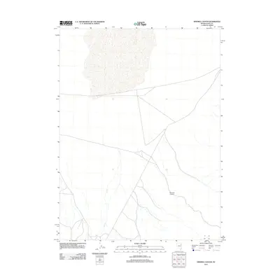
2012 Map of Ninemile Canyon
USGS Topo · Published 2012About this map
Ninemile Canyon provides the primary relief for this portion of Elko County, where the high desert landscape is defined by intermittent drainage and the winding course of Cole Cr. This 2012 survey illustrates a sparsely developed ranching and open-range environment typical of northeastern Nevada, where dirt roads and tracks follow the natural contours of the basin floor. The isolation of the terrain is evident in the vast distances between named landmarks, showing a landscape used primarily for transit and resource management rather than dense settlement. Researchers interested in the topography of the High Desert will find the specific drainage patterns and unpaved travel routes of the canyon system clearly delineated.
Find a feature on this map
2 named features on this map. Tap any name to fly to it.
Don’t see what you’re looking for? This feature index may not catch every label — zoom into the map to look around manually.
Map Details
Editions of this 2012 Ninemile Canyon Map
This is the sole edition of this map. No revisions or reprints were ever made.
Other maps of this area

1953 · Spruce Mountain
USGS Topo · 1:62,500

1953 · Spruce Mountain 4
USGS Topo · 1:62,500

1955 · Elko
USGS Topo · 1:250,000

1958 · Elko
USGS Topo · 1:250,000

1962 · Elko
USGS Topo · 1:250,000

1965 · Elko
USGS Topo · 1:250,000

1968 · Independence Valley SW
USGS Topo · 1:24,000

1968 · Ventosa
USGS Topo · 1:24,000

1968 · Independence Valley SE
USGS Topo · 1:24,000
1985 · Wendover
USGS Topo · 1:100,000