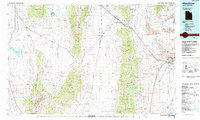
1985 Map of Wendover
USGS Topo · Published 1985About this map
Wendover sits at the eastern edge of this mid-1980s survey, where the Great Salt Lake Desert meets the high basins of eastern Nevada. The landscape is defined by vast north-south corridors like Goshute Valley and Clover Valley, separated by the steep Pequop Mountains and Toano Range. The infrastructure reflects a heavy reliance on transportation and military aviation, centered on the Wendover Air Force Auxiliary Field and the Union Pacific rail lines that navigate the difficult terrain through Silver Zone Pass.
Find a feature on this map
89 named features on this map. Tap any name to fly to it.
Don’t see what you’re looking for? This feature index may not catch every label — zoom into the map to look around manually.
Map Details
Editions of this 1985 Wendover Map
This is the sole edition of this map. No revisions or reprints were ever made.
Other maps of this area

1935 · Halleck
USGS Topo · 1:125,000

1953 · Spruce Mountain
USGS Topo · 1:62,500

1953 · Spruce Mountain 4
USGS Topo · 1:62,500

1953 · Tooele
USGS Topo · 1:250,000

1954 · Brigham City
USGS Topo · 1:250,000

1955 · Tooele
USGS Topo · 1:250,000

1955 · Wells
USGS Topo · 1:250,000

1955 · Elko
USGS Topo · 1:250,000

1958 · Wells
USGS Topo · 1:250,000

1958 · Elko
USGS Topo · 1:250,000