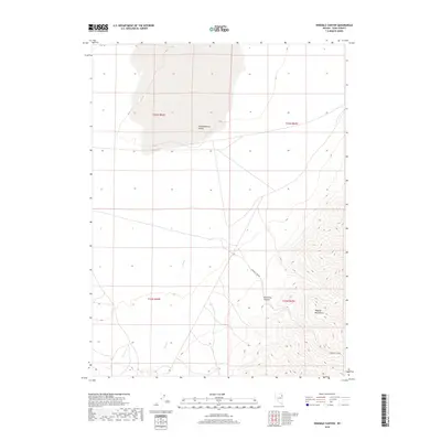
2018 Map of Ninemile Canyon
USGS Topo · Published 2018About this map
The high-desert terrain of Pequop Mountains dominates the eastern portion of this Elko County quadrangle, where steep ridgelines contrast sharply with the broad floor of Independence Valley to the west. This 2018 survey illustrates the varied drainage patterns of the Great Basin, notably the winding course of Cole Cr as it flows toward the valley floor. The topographic detail highlights the namesake Ninemile Canyon, a significant geographic corridor through the mountain range. While the area is largely devoid of formal settlements, the map provides precise section lines and township boundaries—such as t33n r64e and t32n r65e—which are essential for identifying specific tracts of land and understanding the cattle-ranching or mining history of this high-elevation landscape.
Find a feature on this map
9 named features on this map. Tap any name to fly to it.
Don’t see what you’re looking for? This feature index may not catch every label — zoom into the map to look around manually.
Map Details
Editions of this 2018 Ninemile Canyon Map
This is the sole edition of this map. No revisions or reprints were ever made.
Other maps of this area

1953 · Spruce Mountain
USGS Topo · 1:62,500

1953 · Spruce Mountain 4
USGS Topo · 1:62,500

1955 · Elko
USGS Topo · 1:250,000

1958 · Elko
USGS Topo · 1:250,000

1962 · Elko
USGS Topo · 1:250,000

1965 · Elko
USGS Topo · 1:250,000

1968 · Independence Valley SW
USGS Topo · 1:24,000

1968 · Ventosa
USGS Topo · 1:24,000

1968 · Independence Valley SE
USGS Topo · 1:24,000
1985 · Wendover
USGS Topo · 1:100,000