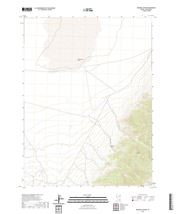
2021 Map of Ninemile Canyon
USGS Topo · Published 2021About this map
Independence Valley dominates the northern half of this topographic study, where the flat basin floor transitions into the rising slopes of the Pequop Mountains to the southeast. The landscape is defined by its drainage patterns, specifically the winding course of Cole Cr and the topographical descent of Ninemile Canyon as it carves through the eastern highlands. This 2021 survey by the U.S. Geological Survey details a high-desert environment in Elko County, structured by the Public Land Survey System grids of T33N R64E and T32N R65E. The map captures the intersection of natural watercourses and the stark topography of the Great Basin, providing a clear view of the mountain-and-valley corridor without the presence of modern urban development.
Find a feature on this map
9 named features on this map. Tap any name to fly to it.
Don’t see what you’re looking for? This feature index may not catch every label — zoom into the map to look around manually.
Map Details
Editions of this 2021 Ninemile Canyon Map
This is the sole edition of this map. No revisions or reprints were ever made.
Other maps of this area

1953 · Spruce Mountain
USGS Topo · 1:62,500

1953 · Spruce Mountain 4
USGS Topo · 1:62,500

1955 · Elko
USGS Topo · 1:250,000

1958 · Elko
USGS Topo · 1:250,000

1962 · Elko
USGS Topo · 1:250,000

1965 · Elko
USGS Topo · 1:250,000

1968 · Independence Valley SW
USGS Topo · 1:24,000

1968 · Ventosa
USGS Topo · 1:24,000

1968 · Independence Valley SE
USGS Topo · 1:24,000
1985 · Wendover
USGS Topo · 1:100,000