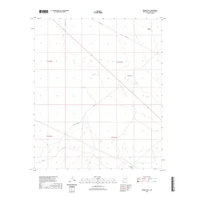
2020 Map of Ninemile Hill
USGS Topo · Published 2020About this map
Ninemile Hill rises as the central landmark in this high-desert reach of Hidalgo County, where the landscape is defined by the ephemeral water management strategies of New Mexico ranchers. The area is marked by a network of catchments, including Odell Tank, Jones Tank, and the House Pasture Tank, which are vital for supporting livestock in this arid environment. These features, along with Lordsburg Draw and Tenmile Canyon, illustrate the drainage patterns of a region where surface water is seasonal and precious.
Find a feature on this map
21 named features on this map. Tap any name to fly to it.
Don’t see what you’re looking for? This feature index may not catch every label — zoom into the map to look around manually.
Map Details
Editions of this 2020 Ninemile Hill Map
This is the sole edition of this map. No revisions or reprints were ever made.
Other maps of this area

1954 · Silver City
USGS Topo · 1:250,000

1958 · Silver City
USGS Topo · 1:250,000

1959 · Redrock
USGS Topo · 1:62,500

1959 · Canador Peak
USGS Topo · 1:62,500

1962 · Silver City
USGS Topo · 1:250,000

1963 · Lordsburg
USGS Topo · 1:24,000

1963 · Culberson Ranch
USGS Topo · 1:24,000
1964 · Summit
USGS Topo · 1:24,000
1964 · Mondel
USGS Topo · 1:24,000

1964 · Gary
USGS Topo · 1:24,000