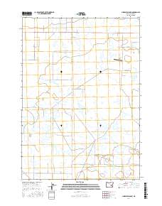
2017 Map of Ninemile Slough
USGS Topo · Published 2017About this map
Harney Valley defines this section of eastern Oregon, where the hydrology of the High Desert is captured through the winding path of Ninemile Slough. The map illustrates a landscape of large-scale land management and agriculture, organized by an extensive grid of section lines and rural routes such as Lawen Harney Rd and Hutchenson Rd. The presence of Hooks Strip suggests the importance of private aviation for navigating and managing these wide-open reaches. Property boundaries and township markers like t23s r32e and t24s r32½ E provide the essential framework for researchers tracing 21st-century land use and lineage in this part of Harney County. The distribution of wetlands across the valley floor highlights the seasonal and structural complexity of the local drainage system.
Find a feature on this map
26 named features on this map. Tap any name to fly to it.
Don’t see what you’re looking for? This feature index may not catch every label — zoom into the map to look around manually.
Map Details
Editions of this 2017 Ninemile Slough Map
This is the sole edition of this map. No revisions or reprints were ever made.
Other maps of this area

1955 · Burns
USGS Topo · 1:250,000

1958 · Burns
USGS Topo · 1:250,000

1959 · Burns
USGS Topo · 1:250,000

1959 · Harney
USGS Topo · 1:62,500

1959 · Lawen
USGS Topo · 1:62,500

1960 · Crane
USGS Topo · 1:62,500

1973 · Buchanan
USGS Topo · 1:24,000

1973 · Carson Point
USGS Topo · 1:24,000

1978 · Malheur Lake
USGS Topo · 1:100,000

1978 · Stinkingwater Mountains
USGS Topo · 1:100,000