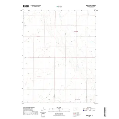
2019 Map of Ninemile Spring
USGS Topo · Published 2019About this map
Ninemile Spring is a central focal point in this portion of Crowley County, where the high plains landscape is defined by drainage patterns and the broad elevation of Antelope Mesa to the south. This 2019 survey documents a rural environment structured by a strict section-line road grid, including Olney Springs Rd and various county lines. Ephemeral waterways like Breckenridge Cr and Cramer Cr cut through the terrain, illustrating the hydrologic character of this arid region. The map reflects the enduring township and range system, with boundaries for t18s r59w and t18s r58w clearly marked. The layout of county roads such as Co Rd V and Co Rd U shows how the land has been subdivided for agricultural or ranching use, maintaining a sparse settlement pattern consistent with this part of the Colorado prairie.
Find a feature on this map
19 named features on this map. Tap any name to fly to it.
Don’t see what you’re looking for? This feature index may not catch every label — zoom into the map to look around manually.
Map Details
Editions of this 2019 Ninemile Spring Map
This is the sole edition of this map. No revisions or reprints were ever made.
Other maps of this area

1889 · Sanborn
USGS Topo · 1:125,000

1891 · Sanborn
USGS Topo · 1:125,000

1891 · Catlin
USGS Topo · 1:125,000

1891 · Nepesta
USGS Topo · 1:125,000

1893 · Nepesta
USGS Topo · 1:125,000

1893 · Sanborn
USGS Topo · 1:125,000

1893 · Big Springs
USGS Topo · 1:125,000

1893 · Catlin
USGS Topo · 1:125,000

1904 · Nepesta
USGS Topo · 1:125,000

1954 · Lamar
USGS Topo · 1:250,000