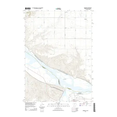
2014 Map of Niobrara
USGS Topo · Published 2014About this map
Niobrara sits at the southern edge of this landscape, positioned near the confluence where the Niobrara River meets the mighty Missouri River. This 2014 survey documents the complex hydrology of the border region between Nebraska and South Dakota, where the Missouri National Recreational River corridor preserves a free-flowing stretch of water characterized by numerous sandbars and landforms like Jones Island. Away from the river bottoms, the topography rises into dissected plains marked by several drainages, including Coffee Cr and Medicine Cr. Local history and genealogy interests are anchored by the small settlement of Perkins and two rural burial grounds: Pioneer Cem and Norwegian Cem, the latter reflecting the ethnic heritage of early settlers who moved into the Missouri valley.
Find a feature on this map
22 named features on this map. Tap any name to fly to it.
Don’t see what you’re looking for? This feature index may not catch every label — zoom into the map to look around manually.
Map Details
Editions of this 2014 Niobrara Map
This is the sole edition of this map. No revisions or reprints were ever made.
Other maps of this area

1950 · Niobrara
USGS Topo · 1:24,000

1950 · Verdel
USGS Topo · 1:24,000

1950 · Verdigre NE
USGS Topo · 1:24,000

1950 · Pishelville
USGS Topo · 1:24,000

1955 · Sioux City
USGS Topo · 1:250,000

1955 · O'Neill
USGS Topo · 1:250,000

1958 · Sioux City
USGS Topo · 1:250,000

1959 · O'Neill
USGS Topo · 1:250,000

1959 · Sioux City
USGS Topo · 1:250,000

1969 · O'Neill
USGS Topo · 1:250,000