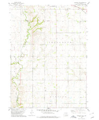
1978 Map of Niobrara NE
USGS Topo · Published 1979About this map
Choteau Creek winds through a landscape defined by its agricultural heritage and early boundaries on this late-1970s survey. The map details the intersection of Bon Homme and Charles Mix counties, notably tracing the Old Indian Treaty Boundary as it cuts across the prairie. The distribution of small rural institutions provides a clear window into the social fabric of the era, from the Mennonite Ch and its namesake Mennonite Sch to other country education centers like Trumbo Sch and Drake Sch.
Find a feature on this map
19 named features on this map. Tap any name to fly to it.
Don’t see what you’re looking for? This feature index may not catch every label — zoom into the map to look around manually.
Map Details
Editions of this 1978 Niobrara NE Map
This is the sole edition of this map. No revisions or reprints were ever made.
Other maps of this area

1898 · Olivet
USGS Topo · 1:125,000

1950 · Niobrara
USGS Topo · 1:24,000

1950 · Verdel
USGS Topo · 1:24,000

1955 · Sioux City
USGS Topo · 1:250,000

1955 · Sioux Falls
USGS Topo · 1:250,000

1955 · Mitchell
USGS Topo · 1:250,000

1955 · O'Neill
USGS Topo · 1:250,000

1958 · Sioux City
USGS Topo · 1:250,000

1958 · Sioux Falls
USGS Topo · 1:250,000

1959 · O'Neill
USGS Topo · 1:250,000