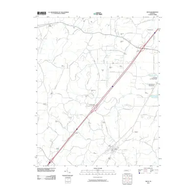
2010 Map of Niota
USGS Topo · Published 2010About this map
The city of Niota anchors this 2010 survey of McMinn County, situated along the base of Niota Ridge. The landscape is a complex network of agriculture and resource extraction, evidenced by a high density of small-scale mining operations like Kyker Mine, Wattenberger Mine, and McManus Mine. Water management is prominent in the eastern quadrant, where the Sweetwater Creek Project Lake and reservoirs such as Sweetwater Creek Watershed Number One Reservoir regulate the drainage of the East Fork North Mouse Creek valley.
Find a feature on this map
109 named features on this map. Tap any name to fly to it.
Don’t see what you’re looking for? This feature index may not catch every label — zoom into the map to look around manually.
Map Details
Editions of this 2010 Niota Map
This is the sole edition of this map. No revisions or reprints were ever made.
Other maps of this area

1886 · Cleveland
USGS Topo · 1:125,000

1887 · Kingston
USGS Topo · 1:125,000

1891 · Kingston
USGS Topo · 1:125,000

1892 · Cleveland
USGS Topo · 1:125,000

1893 · Murphy
USGS Topo · 1:125,000

1893 · Kingston
USGS Topo · 1:125,000

1895 · Cleveland
USGS Topo · 1:125,000

1895 · Loudon
USGS Topo · 1:125,000

1901 · Cleveland
USGS Topo · 1:125,000

1914 · Murphy
USGS Topo · 1:125,000