Loading...
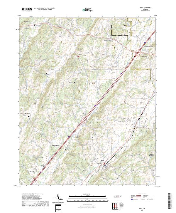
Loading map...2022 Map of Niota
USGS Topo · Published 2022About this map
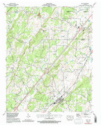
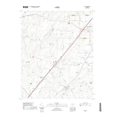
Niota and the surrounding McMinn and Monroe County line are defined by the broad drainage patterns of the Sweetwater Valley. The terrain is shaped by several parallel ridges, including Kennedy Ridge and Spring Creek Ridge, which guide the flow of N Mouse Cr and Sweetwater Cr. The map reveals a landscape heavily dotted with ancestral burial grounds, such as Beulah Chapel Cem and Shearman Cem, alongside former industrial hubs like Acme Mill and Barton Mill.
Find a feature on this map
161 named features on this map. Tap any name to fly to it.
Don’t see what you’re looking for? This feature index may not catch every label — zoom into the map to look around manually.
Map Details
Date Portrayed2022
Date Published2022
PublisherU.S. Geological Survey
Map TypeTopographic
Scale1:24,000
Physical Dimensions24 x 29 inches
Editions of this 2022 Niota Map
This is the sole edition of this map. No revisions or reprints were ever made.
Historical Maps of Athens Through Time
9 maps found
Featured Locations
Source Details
SourceU.S. Geological Survey
CopyrightPublic Domain