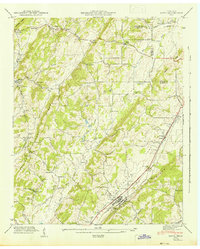
1942 Map of Niota
USGS Topo · Published 1942About this map
Niota sits as the primary hub along the Southern railroad line in this 1942 survey of McMinn County, Tennessee. The landscape is defined by the parallel ridges of Kennedy Ridge and Watson Ridge, which channel the drainage of numerous small waterways including North Mouse Creek and Big Sewee Creek. This era reveals a decentralized rural economy, where local milling operations like Barton Mill and Acme Mill served the surrounding agricultural valleys.
Find a feature on this map
50 named features on this map. Tap any name to fly to it.
Don’t see what you’re looking for? This feature index may not catch every label — zoom into the map to look around manually.
Map Details
Editions of this 1942 Niota Map
This is the sole edition of this map. No revisions or reprints were ever made.
Other maps of this area

1886 · Cleveland
USGS Topo · 1:125,000

1887 · Kingston
USGS Topo · 1:125,000

1891 · Kingston
USGS Topo · 1:125,000

1892 · Cleveland
USGS Topo · 1:125,000

1893 · Murphy
USGS Topo · 1:125,000

1893 · Kingston
USGS Topo · 1:125,000

1895 · Cleveland
USGS Topo · 1:125,000

1895 · Loudon
USGS Topo · 1:125,000

1901 · Cleveland
USGS Topo · 1:125,000

1914 · Murphy
USGS Topo · 1:125,000