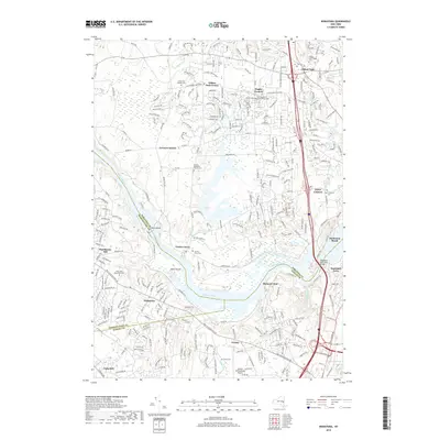
2019 Map of Niskayuna
USGS Topo · Published 2019About this map
Mohawk River flows through the center of this landscape, separating the residential expansions of Niskayuna and Verdoy in the south from the hamlets of Saratoga County to the north. This modern topography documents the suburban character of the Capital Region, where historic river crossings like Vischer Ferry and Dunsbach Ferry contrast with the massive engineering of the Thaddeus Kosciuszko Bridge carrying Interstate 87. The map reveals a dense network of local cemeteries, including the Clifton Park Village Cem and Vischer Ferry Cem, which serve as permanent markers of earlier rural settlements now integrated into the growing corridors of Clifton Park and Flagler Corners. To the south, the presence of the Albany International Airport and the distinct path of the Lisha Kill define the transition from industrial and transit hubs to the wooded banks of Goat Island and Niska Island.
Find a feature on this map
48 named features on this map. Tap any name to fly to it.
Don’t see what you’re looking for? This feature index may not catch every label — zoom into the map to look around manually.
Map Details
Editions of this 2019 Niskayuna Map
This is the sole edition of this map. No revisions or reprints were ever made.
Other maps of this area

1893 · Cohoes
USGS Topo · 1:62,500

1893 · Troy
USGS Topo · 1:62,500

1893 · Schenectady
USGS Topo · 1:62,500

1893 · Albany
USGS Topo · 1:62,500

1895 · Troy
USGS Topo · 1:62,500

1895 · Cohoes
USGS Topo · 1:62,500

1895 · Albany
USGS Topo · 1:62,500

1895 · Schenectady
USGS Topo · 1:62,500

1898 · Schenectady
USGS Topo · 1:62,500

1898 · Albany
USGS Topo · 1:62,500