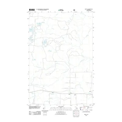
2011 Map of Nisula
USGS Topo · Published 2011About this map
Nisula and the nearby settlement of Alston anchor this portion of the Upper Peninsula, characterized by a complex network of waterways and early 21st-century rural roads. The area's community identity is centered around the Nisula Post Office and the Nisula Lutheran Cemetery, while the landscape is defined by the West Branch Otter River and the dramatic drop at Otter Falls. Numerous smaller lakes, including Emily Lake, Pike Lake, and Lake Fourteen, dot the northern terrain.
Find a feature on this map
45 named features on this map. Tap any name to fly to it.
Don’t see what you’re looking for? This feature index may not catch every label — zoom into the map to look around manually.
Map Details
Editions of this 2011 Nisula Map
This is the sole edition of this map. No revisions or reprints were ever made.
Other maps of this area

1954 · Rousseau
USGS Topo · 1:62,500

1954 · Pelkie
USGS Topo · 1:62,500

1954 · Winona
USGS Topo · 1:62,500

1954 · Sidnaw
USGS Topo · 1:62,500

1958 · Iron River
USGS Topo · 1:250,000

1960 · Iron River
USGS Topo · 1:250,000

1961 · Iron River
USGS Topo · 1:250,000

1967 · Iron River
USGS Topo · 1:250,000
1982 · Nisula
USGS Topo · 1:25,000
1982 · Donken
USGS Topo · 1:25,000