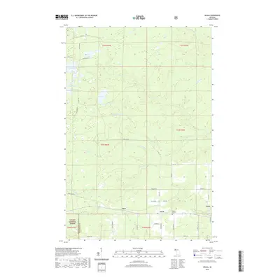
2019 Map of Nisula
USGS Topo · Published 2019About this map
Nisula and Alston anchor this portion of Houghton County within the Ottawa National Forest. The landscape is defined by its complex drainage systems and numerous water bodies, including Emily Lake, Sandy Lake, and Lake Fifteen. The network of backroads such as Alston Trl and Pike Lake Rd connects these rural settlements, while the Nisula Lutheran Cem serves as a vital point of interest for those tracing local family histories in this part of Michigan's Upper Peninsula. The course of the W Br Otter River and the presence of Otter Falls illustrate the topography that influenced early navigation and land use. Small communities like White are situated along the southern corridor, highlighting the historical settlement patterns typical of this forest-rich region near the Ontonagon County line.
Find a feature on this map
50 named features on this map. Tap any name to fly to it.
Don’t see what you’re looking for? This feature index may not catch every label — zoom into the map to look around manually.
Map Details
Editions of this 2019 Nisula Map
This is the sole edition of this map. No revisions or reprints were ever made.
Other maps of this area

1954 · Rousseau
USGS Topo · 1:62,500

1954 · Pelkie
USGS Topo · 1:62,500

1954 · Winona
USGS Topo · 1:62,500

1954 · Sidnaw
USGS Topo · 1:62,500

1958 · Iron River
USGS Topo · 1:250,000

1960 · Iron River
USGS Topo · 1:250,000

1961 · Iron River
USGS Topo · 1:250,000

1967 · Iron River
USGS Topo · 1:250,000
1982 · Nisula
USGS Topo · 1:25,000
1982 · Donken
USGS Topo · 1:25,000