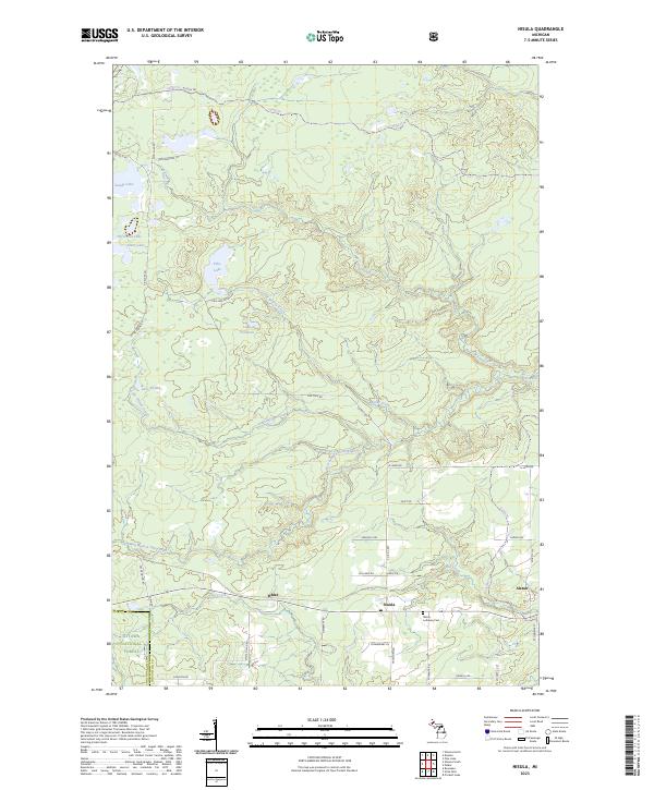
2023 Map of Nisula
USGS Topo · Published 2023About this map
Nisula and Alston serve as the primary focal points of this contemporary topographic survey of south-central Houghton County. Located within the Ottawa National Forest, the landscape is defined by a dense network of water bodies and tributary streams, including Lake Fifteen, Pike Lake, and the meandering West Branch Otter River. Local heritage is anchored by the Nisula Lutheran Cem, while the historical importance of the regional timber and transport industries is reflected in road names such as Otter Siding Rd, White Siding Rd, and the Alston Trl. This modern mapping provides a clear view of how established property lines and forest management roads like N Laird Rd and Co Rd E-657 navigate the complex drainage systems of Mill Creek and Greenier Creek.
Find a feature on this map
52 named features on this map. Tap any name to fly to it.
Don’t see what you’re looking for? This feature index may not catch every label — zoom into the map to look around manually.
Map Details
Editions of this 2023 Nisula Map
This is the sole edition of this map. No revisions or reprints were ever made.
Other maps of this area

1954 · Rousseau
USGS Topo · 1:62,500

1954 · Pelkie
USGS Topo · 1:62,500

1954 · Winona
USGS Topo · 1:62,500

1954 · Sidnaw
USGS Topo · 1:62,500

1958 · Iron River
USGS Topo · 1:250,000

1960 · Iron River
USGS Topo · 1:250,000

1961 · Iron River
USGS Topo · 1:250,000

1967 · Iron River
USGS Topo · 1:250,000
1982 · Nisula
USGS Topo · 1:25,000
1982 · Donken
USGS Topo · 1:25,000