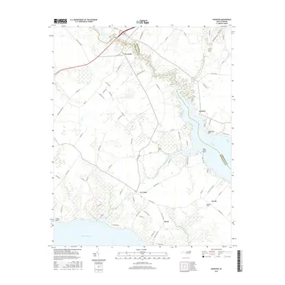
2016 Map of Nixonton
USGS Topo · Published 2016About this map
Durants Neck extends into the meeting of coastal waters where the Perquimans River and Little River define the local geography. This maritime landscape in northeastern North Carolina is characterized by intricate wetlands like Great Run Swamp and a network of tidal creeks, including Halls Creek and Deep Creek. The interior is dotted with small rural settlements such as Woodville, Nixonton, and New Hope, which reflect a long history of agricultural and river-based community life. Genealogists and local researchers will find several family-named burial sites across the terrain, including Wilson Cem, Godfrey Cem, and Jackson Cem. The map illustrates how modern roads like the Old Hertford Hwy and Okisko Rd follow the high ground between the drainage basins of Sutton Cr and Muddy Creek.
Find a feature on this map
87 named features on this map. Tap any name to fly to it.
Don’t see what you’re looking for? This feature index may not catch every label — zoom into the map to look around manually.
Map Details
Editions of this 2016 Nixonton Map
This is the sole edition of this map. No revisions or reprints were ever made.
Other maps of this area

1906 · Hertford
USGS Topo · 1:62,500

1940 · Hertford
USGS Topo · 1:62,500

1940 · Wade Point
USGS Topo · 1:62,500

1940 · South Mills
USGS Topo · 1:62,500

1943 · Wade Point
USGS Topo · 1:62,500

1948 · Wade Point
USGS Topo · 1:62,500

1948 · Elizabeth City
USGS Topo · 1:62,500

1952 · South Mills
USGS Topo · 1:62,500

1953 · Norfolk
USGS Topo · 1:250,000

1982 · Nixonton
USGS Topo · 1:24,000