
1942 Map of Nixonville
USGS Topo · Published 1942About this map
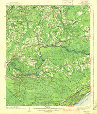
The Waccamaw River winds through this coastal South Carolina landscape, defining a region characterized by extensive wetlands and scattered rural communities. In the years preceding the Second World War, the area was a network of family-centered settlements and small agricultural outposts such as Daisy and Red Bluff. The map reveals a dense social infrastructure of local institutions, including the Poplar Training Sch, New Home Ch, and several cemeteries like Pleasant Grove Cem and Chestnut Cem, which provide significant data points for genealogical research.
Find a feature on this map
117 named features on this map. Tap any name to fly to it.
Don’t see what you’re looking for? This feature index may not catch every label — zoom into the map to look around manually.
Map Details
Editions of this 1942 Nixonville Map
2 editions found
Other maps of this area

1937 · Myrtle Beach
USGS Topo · 1:48,000

1937 · Nixonville
USGS Topo · 1:48,000

1940 · Myrtle Beach
USGS Topo · 1:62,500

1943 · Pireway
USGS Topo · 1:31,680

1943 · Wampee
USGS Topo · 1:24,000

1943 · Bucksville
USGS Topo · 1:24,000

1943 · Adrian
USGS Topo · 1:24,000

1943 · Conway
USGS Topo · 1:24,000

1944 · Longs
USGS Topo · 1:31,680

1944 · Adrian
USGS Topo · 1:31,680