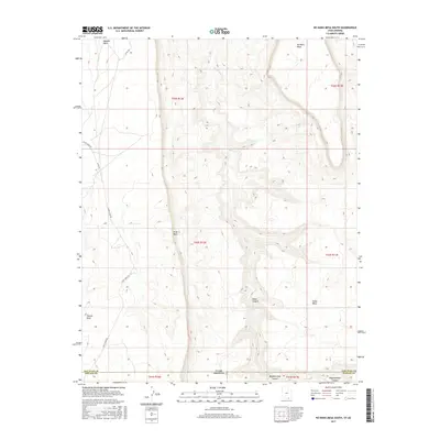
2017 Map of No Mans Mesa South
USGS Topo · Published 2017About this map
No Mans Mesa and Piute Mesa dominate this high-desert landscape along the border of Utah and Arizona. The region is defined by deep incisions in the earth, most notably Nokai Canyon and Begashinitani Canyon, which channel drainage toward the north through Nokai Cr. The terrain is characterized by massive flat-topped formations such as Nokai Mesa and the distinct landmark of Thumb Rock. Human presence is marked by sparse infrastructure, including Piute Creek Rd and Co RD 434, which wind through the complex topography of the San Juan and Navajo county line. The map captures a moment in the modern era where traditional land divisions of the Public Land Survey System meet the natural boundaries of the Colorado Plateau.
Find a feature on this map
18 named features on this map. Tap any name to fly to it.
Don’t see what you’re looking for? This feature index may not catch every label — zoom into the map to look around manually.
Map Details
Editions of this 2017 No Mans Mesa South Map
This is the sole edition of this map. No revisions or reprints were ever made.
Other maps of this area

1883 · Marsh Pass
USGS Topo · 1:250,000

1886 · Henry Mountains
USGS Topo · 1:250,000

1892 · Marsh Pass
USGS Topo · 1:250,000

1892 · Henry Mountains
USGS Topo · 1:250,000
1952 · Shato Spring 1 NE
USGS Topo · 1:24,000
1952 · Agathla Peak 2 NW
USGS Topo · 1:24,000
1952 · Boot Mesa
USGS Topo · 1:62,500
1952 · Clay Hills 3 SW
USGS Topo · 1:24,000
1952 · Clay Hills 3 NW
USGS Topo · 1:24,000
1952 · Navajo Mtn. 4 SE
USGS Topo · 1:24,000