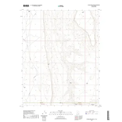
2020 Map of No Mans Mesa South
USGS Topo · Published 2020About this map
Piute Mesa and No Mans Mesa dominate this high-desert landscape along the border where Navajo County, Arizona, meets San Juan County, Utah. The terrain is defined by deep incisions from Nokai Canyon and Begashinitani Canyon, showing the complex drainage systems that feed into Nokai Cr and Neskahi Wash. The cartography highlights the verticality of the region, featuring prominent landmarks such as Thumb Rock and the extensive Nokai Mesa. This 2020 survey illustrates how modern infrastructure like Piute Creek Rd and Co Rd 434 navigates the ancient geological formations of the t41n r16e and t41n r17e townships. The map provides a precise record of the international state line and county boundaries as they intersect this high-plateau environment.
Find a feature on this map
14 named features on this map. Tap any name to fly to it.
Don’t see what you’re looking for? This feature index may not catch every label — zoom into the map to look around manually.
Map Details
Editions of this 2020 No Mans Mesa South Map
This is the sole edition of this map. No revisions or reprints were ever made.
Other maps of this area

1883 · Marsh Pass
USGS Topo · 1:250,000

1886 · Henry Mountains
USGS Topo · 1:250,000

1892 · Marsh Pass
USGS Topo · 1:250,000

1892 · Henry Mountains
USGS Topo · 1:250,000

1952 · Shato Spring 1 NE
USGS Topo · 1:24,000

1952 · Agathla Peak 2 NW
USGS Topo · 1:24,000

1952 · Boot Mesa
USGS Topo · 1:62,500

1952 · Clay Hills 3 SW
USGS Topo · 1:24,000

1952 · Clay Hills 3 NW
USGS Topo · 1:24,000

1952 · Navajo Mtn. 4 SE
USGS Topo · 1:24,000