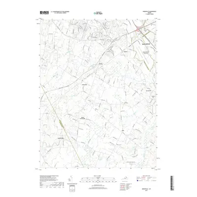
2019 Map of Nokesville
USGS Topo · Published 2019About this map
The Culpeper Basin landscape south of Manassas reveals a complex network of historical rural settlements and evolving transport hubs. The area is defined by the significant waterways of Kettle Run, Broad Run, and Slate Run, which historically supported the agriculture and early industry of Prince William County. Central to this geography is the Nokesville Truss Bridge, a notable landmark along the rail lines that helped develop communities like Bristow and Nokesville.
Find a feature on this map
138 named features on this map. Tap any name to fly to it.
Don’t see what you’re looking for? This feature index may not catch every label — zoom into the map to look around manually.
Map Details
Editions of this 2019 Nokesville Map
This is the sole edition of this map. No revisions or reprints were ever made.
Other maps of this area

1890 · Mt. Vernon
USGS Topo · 1:125,000

1891 · Mt. Vernon
USGS Topo · 1:125,000

1894 · Warrenton
USGS Topo · 1:125,000

1894 · Mt. Vernon
USGS Topo · 1:125,000

1897 · Mt. Vernon
USGS Topo · 1:125,000

1915 · Fairfax
USGS Topo · 1:62,500

1927 · Quantico
USGS Topo · 1:62,500

1933 · Middleburg
USGS Topo · 1:62,500

1940 · Quantico
USGS Topo · 1:62,500

1943 · Quantico
USGS Topo · 1:62,500