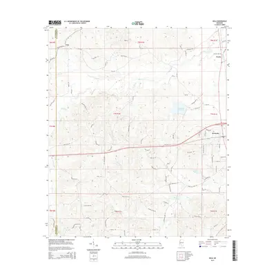
2015 Map of Nola
USGS Topo · Published 2015About this map
Monticello anchors the eastern edge of this Lawrence County landscape, situated along the banks of the Fair River. The terrain is defined by a dense network of winding creeks and family-named roads, reflecting the deep-rooted rural character of south-central Mississippi. Significant water features such as Lake Mary Crawford and the Joseph Neylans Spring provide focal points for the surrounding topography, which is carved by the drainages of Bear Cr, Halls Cr, and Perch Cr.
Find a feature on this map
85 named features on this map. Tap any name to fly to it.
Don’t see what you’re looking for? This feature index may not catch every label — zoom into the map to look around manually.
Map Details
Editions of this 2015 Nola Map
This is the sole edition of this map. No revisions or reprints were ever made.
Other maps of this area

1953 · Natchez
USGS Topo · 1:250,000

1956 · Natchez
USGS Topo · 1:250,000

1959 · Natchez
USGS Topo · 1:250,000

1970 · Topeka
USGS Topo · 1:24,000

1970 · Monticello
USGS Topo · 1:24,000

1970 · Nola
USGS Topo · 1:24,000
1970 · Tilton
USGS Topo · 1:24,000
1971 · Monticello NE
USGS Topo · 1:24,000

1971 · Oma
USGS Topo · 1:24,000

1972 · Fair Oak Springs
USGS Topo · 1:24,000