
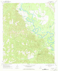
1970 Map of Topeka
USGS Topo · Published 1972About this map
The rural community of Topeka and the neighboring settlement at Divide anchor this detailed study of the border between Lawrence and Lincoln counties. Photographed in the late 1960s, the landscape is defined by its social centers, including numerous country churches such as Ballards Chapel, Bethany Ch, and Powells Grove Ch. The presence of the Topeka-Tilton Sch highlights the consolidation of local education near the geographic center of the sheet.
Find a feature on this map
24 named features on this map. Tap any name to fly to it.
Don’t see what you’re looking for? This feature index may not catch every label — zoom into the map to look around manually.
Map Details
Editions of this 1970 Topeka Map
This is the sole edition of this map. No revisions or reprints were ever made.
Other maps of this area

1953 · Natchez
USGS Topo · 1:250,000

1956 · Natchez
USGS Topo · 1:250,000

1959 · Natchez
USGS Topo · 1:250,000

1970 · Monticello
USGS Topo · 1:24,000

1970 · Darbun
USGS Topo · 1:24,000

1970 · Jayess
USGS Topo · 1:24,000

1970 · Nola
USGS Topo · 1:24,000
1970 · Tilton
USGS Topo · 1:24,000

1972 · Fair Oak Springs
USGS Topo · 1:24,000

1972 · Ruth
USGS Topo · 1:24,000